The River Axe Landscape Recovery Project
Vet Sustain were recently invited to join Alasdair Moffett, Project Manager for the Upper Axe Landscape Recovery Project for a 'river walk' at Grovefield Farm in Dorset to see the river restoration project that has been underway for the last year.
Hannah Davies
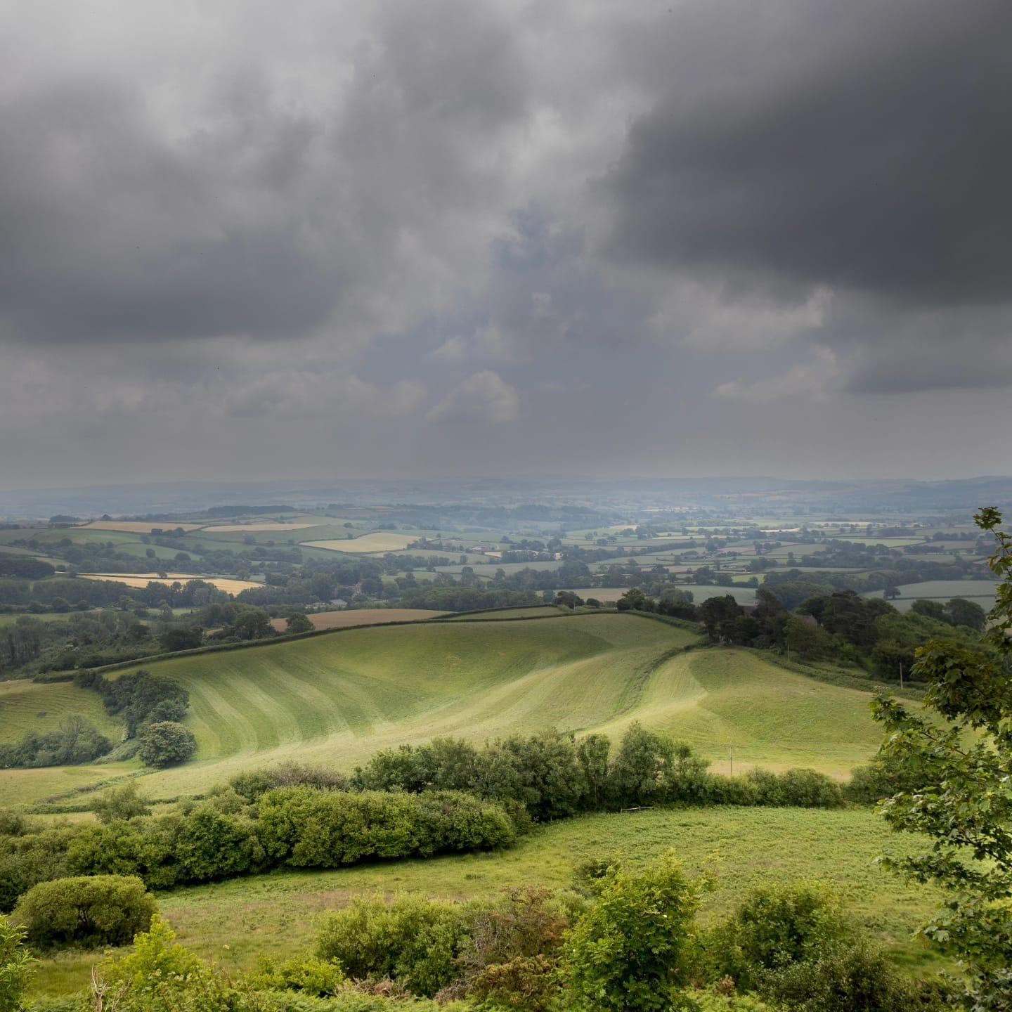
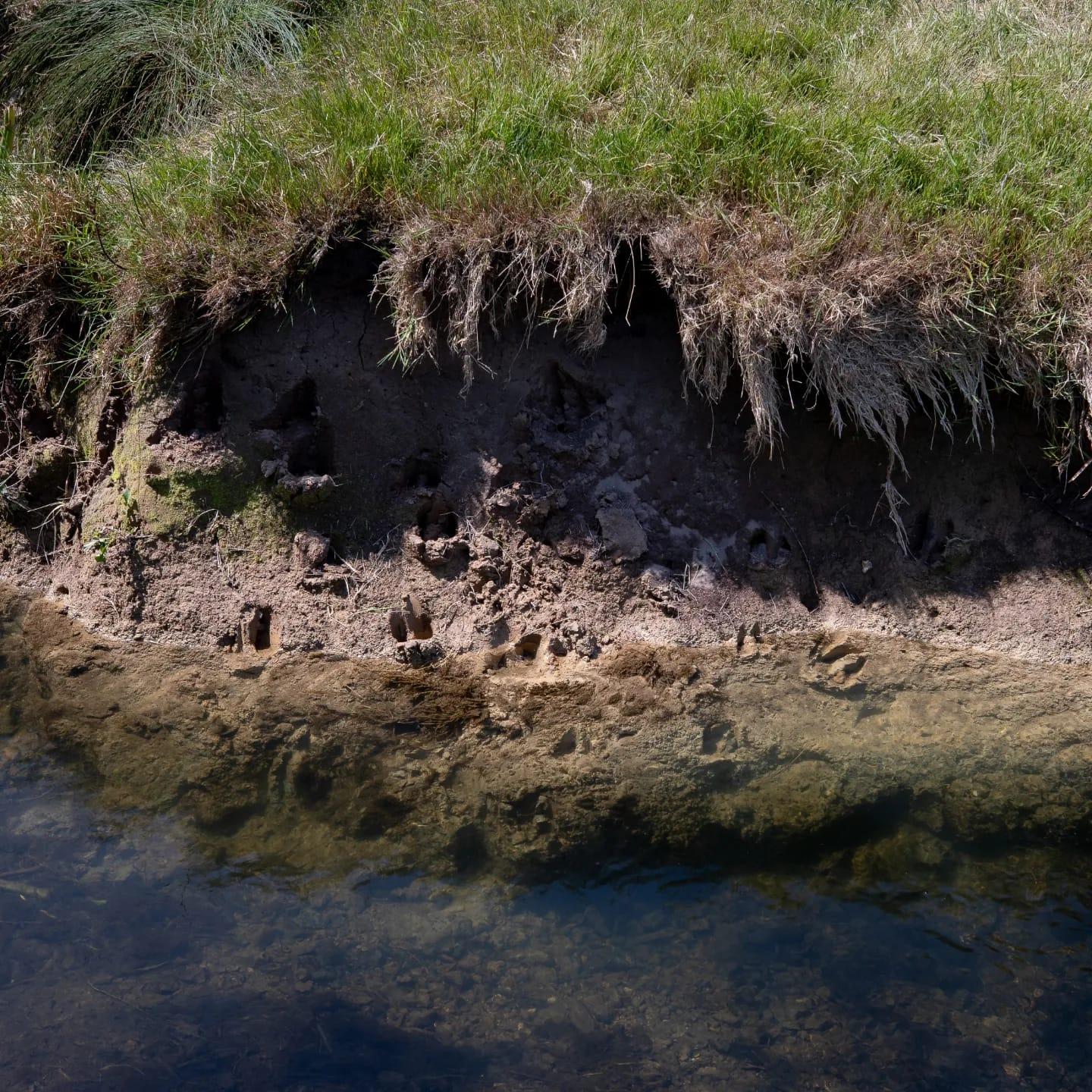
The River Axe, with its 370 km2 catchment, which flows for 22 miles through Dorset, Somerset and Devon, is a very special place. As such it has been recognized as a Site of Special Scientific Interest (SSSI) as well as a Special Area of Conservation (SAC). The river hosts a biodiverse natural habitat for a wide variety of species including marginal and aquatic plants and threatened animal species such as otter, bullhead, medicinal leech and salmon. However, after decades of intense land management the river has become badly degraded and is now thought to be in an unfavorable condition due to silt accumulation within the channel, nutrient enrichment (primarily phosphorus) and algae overgrowth.
Chris Banyard of Whetley Cross Farm in Mosterton, Dorset is custodian to part of the Upper Axe river catchment and has recently been involved in the River Axe Landscape Recovery Project, supported and part funded by DEFRAs Landscape Recovery Scheme. Over the past decade, Chris has seen the river change in response to straightening and deepening of the channel and subsequent increased river velocity and destabilization of the river bed. The condition of the riverbed is dependent on retention of the cobbles and gravels that were deposited during the ice age. As the hard cobble bed has been washed away, the river has been rapidly eroded, increasing the channel size and velocity, concentrating flood water velocity and depriving wildlife spawning habitat. Chris has committed to supporting the recovery of the river catchment through re-engagement of the river with its floodplain, limiting further river channel deterioration and restoration of the natural habitat.
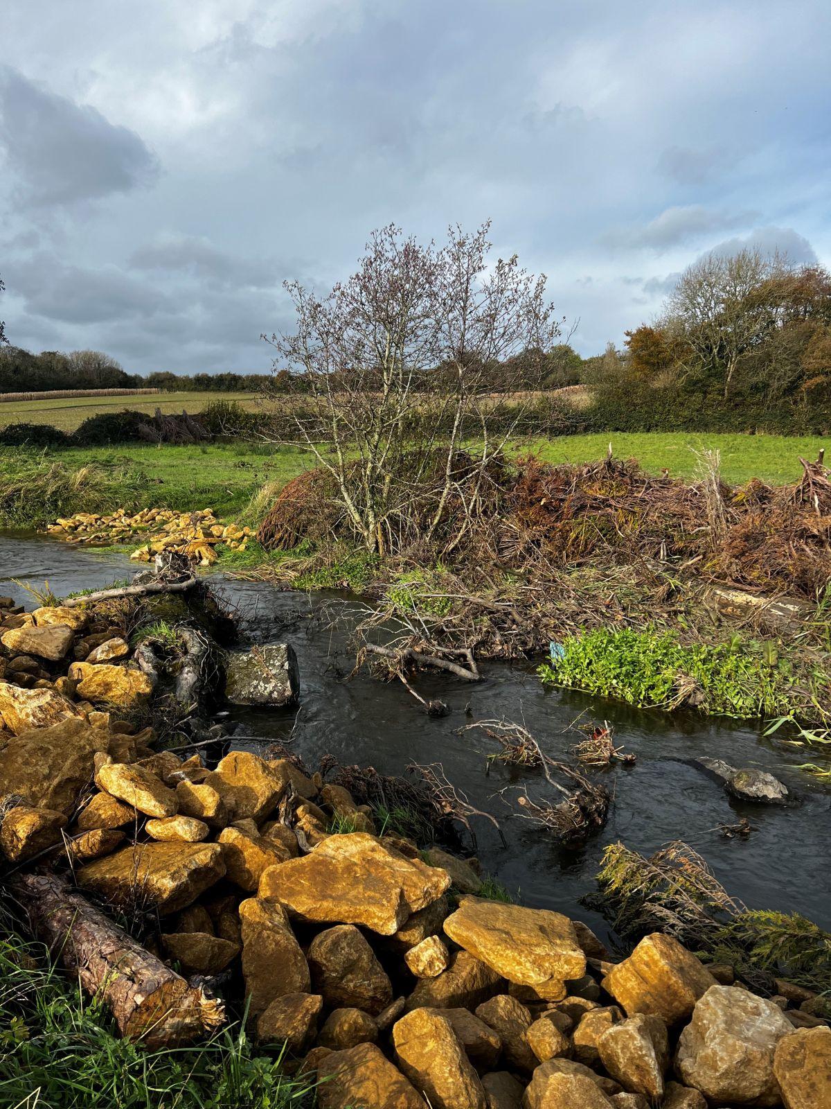
Phase 1 of the project started in October 2022 and involved 150m of the meandering river channel. This phase was focused around the use of brash mattresses pinned down with securing stakes to elevate the river bed bringing it closer to the floodplain. Chris utilized brash from hedge cutting across the farm over the previous winter alongside wooden stakes sourced from fallen trees within 2km of the site. Use of brash in this way not only prevents further erosion of the riverbed but also captures and retains silt from and sediment released upstream which over time will create a new riverbed.
Within the floodplain a 150m2 shallow scrape was built allowing water to flow over the floodplain and find its own path back to the river. This scrape now provides a wetland area promoting further biodiversity and natural habitat within the river catchment. The 2.6 hectare floodplain will be planted with native trees and shrubs over the winter of 2023 ensuring at least 40% open space is maintained around the scrape to allow sunlight to reach the wetland habitat.
A further 200m of the river, adjacent to the phase 1 reach, was restored as the second phase of the project, This second phase, focused on the use of local stone to top the woody brash, providing a substrate for silt and gravel deposition as well as the creation of four stone check dams built at equal intervals along the river stretch.
Alasdair Moffett, Project Manager for the Upper Axe Landscape Recovery project and local farm vet organized a river walk in November 2023 to showcase the work that has been carried out along the river catchment at Whetley Cross Farm. This walk brought together local farmers, landowners, vets, and key stakeholders for the project.
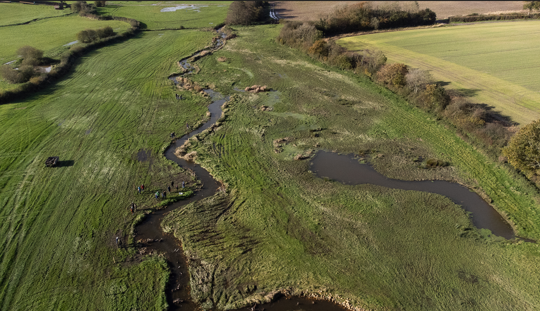
Clear re-connection of the river with its floodplain could be seen with visible silt deposition occurring on the floodplain during flood events. Initial water quality monitoring carried out in January-March 2023 showed slight reductions in phosphate levels but similar suspended solids results above and below the intervention. Although improvements in water quality have not yet been seen, it is thought that the phase 1 interventions have resulted in 30cm of fine silt deposition on top of the woody brash within the river channel and net deposition of silt onto the floodplain. It is hoped that further water quality monitoring over a longer period of time will show a correlation with improved river water quality in the area of restoration. Fish passage has been monitored as part of the project and no impediment to fish movement have been seen as a result of the interventions. Ongoing monitoring and measurement is planned to help inform, refine and modify future interventions with the Upper Axe Landscape Recovery Project in the hope to restore larger sections of the main River Axe and its tributaries in the future. More information on this interesting restoration project can be found here: https://upperaxe.org/